Kathmandu
From Wikipedia, the free encyclopedia
This article is about Kathmandu city. For other uses, see Kathmandu (disambiguation).
| Kathmandu येँ देय् काठमाडौं महानगर |
|
|---|---|
| — Capital City — | |
 |
|
| Motto: My legacy, my pride, my Kathmandu | |
 |
|

Kathmandu
|
|
| Coordinates: 27°42′N 85°20′ECoordinates: 27°42′N 85°20′E | |
| Country | |
| Development Region | Central |
| Zone | Bagmati Zone |
| District | Kathmandu District |
| HDI | |
| Established | 900s AD[2] |
| Government | |
| • Chief Executive Officer | Kedar Bahadur Adhikari |
| Area | |
| • Total | 49.45 km2 (19.09 sq mi) |
| Elevation | 1,400 m (4,600 ft) |
| Population (2012) | |
| • Total | About 2.5 Million[3] |
| census | |
| Time zone | Nepal Time (UTC+5:45) |
| Postal Code | 44600 (GPO), 44601, 44602, 44604, 44605, 44606, 44608, 44609, 44610, 44611, 44613, 44614, 44615, 44616, 44617, 44618, 44619, 44620, 44621 |
| Area code(s) | 01 |
| Website | kathmandu.gov.np |

The city stands at an elevation of approximately 1,400 metres (4,600 ft) in the bowl-shaped Kathmandu Valley of central Nepal. It is surrounded by four major mountains: Shivapuri, Phulchoki, Nagarjun, and Chandragiri. Kathmandu Valley is part of three districts (Kathmandu, Lalitpur, and Bhaktapur), has the highest population density in the country, and is home to about a twelfth of Nepal's population.
During Rana and Shah eras, the name "Nepal" referred only to the Kathmandu Valley; it was what people who lived outside the valley called it. During this period, British historians called the valley itself "Nepal Proper". Today, Kathmandu is not only the capital of the Federal Democratic Republic of Nepal, but also the headquarters of the Central Development Region of Nepal. The Central Region comprises three zones: Bagmati, Narayani, and Janakpur. Kathmandu is located in the Bagmati Zone.[8]
Kathmandu is the gateway to tourism in Nepal. It is also the nerve center of the country's economy. It has the most advanced infrastructure of any urban area in Nepal, and its economy is focused on tourism, which accounted for 3.8% of Nepal's GDP in 1995–96. (Tourism in Kathmandu declined thereafter during a period of political unrest, but since then has improved.)
The city has a rich history, spanning nearly 2000 years, as inferred from inscriptions found in the valley. Religious and cultural festivities form a major part of the lives of people residing in Kathmandu. Most of Kathmandu's people follow Hinduism and many others follow Buddhism. There are people of other religious beliefs as well, giving Kathmandu a cosmopolitan culture. Nepali is the most commonly spoken language in the city. Nepal Bhasa is the indigenous language spoken by the Newar people. Hindi is widely understood and English is understood by Kathmandu's educated residents. The city's literacy rate is 98%.[9]
Kathmandu's sister cities (Lalitpur Patan) and Bhaktapur are integral to Kathmandu's cultural heritage, tourism industry, and economy; therefore UNESCO's World Heritage Site lists all three cities' monuments and attractions together under one heading, "Kathmandu Valley-UNESCO World Heritage Site".[10][11]
Contents
- 1 Toponymy
- 2 History
- 3 Geography
- 4 Climate
- 5 Economy
- 6 Government and public services
- 7 Demographics
- 8 Architecture and cityscape
- 9 Culture
- 10 Education
- 11 Sports
- 12 Transport
- 13 Healthcare
- 14 Media
- 15 In popular culture
- 16 International relations
- 17 Sister cities
- 18 See also
- 19 Footnotes
- 20 References
- 21 External links
Toponymy

The colophons of ancient manuscripts, dated as late as the previous century[when?], refer to Kathmandu as Kasthamandap Mahanagar in Nepal Mandala. Mahanagar means "great city". The city is called "Kasthamandap" in a vow that Buddhist priests still recite to this day. During medieval times, the city was sometimes called Kantipur (कान्तिपुर). This name is derived from two Sanskrit words - Kanti and pur. "Kanti" is one of the names of the Goddess Lakshmi, and "pur" means place. Thus Kathmandu also known as Kasthamandap.
Among the indigenous Newar people, Kathmandu is known as Yen Desa (येँ देश), and Patan and Bhaktapur are known as Yala Desa (यल देश) and Khwopa Desa (ख्वप देश).[13] "Yen" is the shorter form of Yambu (यम्बु), which originally referred to the northern half of Kathmandu[clarification needed].[14]
History
Main article: History of Kathmandu

Ancient history
The ancient history of Kathmandu is described in its traditional myths and legends. According to Swayambhu Purana, the present day Kathmandu was once a lake called Nagdaha. The lake was drained by Manjusri, who established a city called Manjupattan and made Dharmakar the ruler of the land.[16][17][18]Very few historical records exist of the period before the medieval Licchavis rulers. According to Gopalraj Vansawali, a genealogy of Nepalese monarchs, the rulers of Kathmandu Valley before the Licchavis were Gopalas, Mahispalas, Aabhirs, Kirants, and Somavanshi.[18][19] The Kirata dynasty was established by Yalamber. During the Kirata era, a settlement called Yambu existed in the northern half of old Kathmandu. In some of the Sino-Tibetan languages, Kathmandu is still called Yambu. Another smaller settlement called Yengal was present in the southern half of old Kathmandu, near Manjupattan. During the reign of the seventh Kirata ruler, Jitedasti, Buddhist monks entered Kathmandu valley and established a forest monastery at Sankhu.
Medieval history

Licchavi era
The Licchavis from the Indo-Gangetic plain migrated north and defeated the Kiratas, establishing the Licchavi dynasty. During this era, following the genocide of Shakyas in Lumbini by Virudhaka, the survivors migrated north and entered the forest monastery in Sankhu masquerading as Koliyas. From Sankhu, they migrated to Yambu and Yengal (Lanjagwal and Manjupattan) and established the first permanent Buddhist monasteries of Kathmandu. This created the basis of Newar Buddhism, which is the only surviving Sanskrit-based Buddhist tradition in the world.[20] With their migration, Yambu was called Koligram and Yengal was called Dakshin Koligram[21] during most of the Licchavi era.[22]Eventually, the Lichhavi ruler Gunakamadeva merged Koligram and Dakshin Koligram, founding the city of Kathmandu.[22] The city was designed in the shape of Chandrahrasa, the sword of Manjushri. The city was surrounded by eight barracks guarded by Ajimas. One of these barracks is still in use at Bhadrakali (in front of Singha Durbar). The city served as an important transit point in the trade between India and Tibet, leading to tremendous growth in architecture. Descriptions of buildings such as Managriha, Kailaskut Bhawan, and Bhadradiwas Bhawan have been found in the surviving journals of travelers and monks who lived during this era. For example, the famous 7th-century Chinese traveller Xuanzang described Kailaskut Bhawan, the palace of the Licchavi king Amshuverma.[23] The trade route also led to cultural exchange as well. The artistry of the Newar people—the indigenous inhabitants of the Kathmandu Valley—became highly sought after during this era, both within the Valley and throughout the greater Himalayas. Newar artists travelled extensively throughout Asia, creating religious art for their neighbors. For example, Araniko led a group of his compatriot artists through Tibet and China. Bhrikuti, the princess of Nepal who married Tibetan monarch Songtsän Gampo, was instrumental in introducing Buddhism to Tibet.
Malla era

During the later part of the Malla era, Kathmandu Valley comprised four fortified cities: Kantipur, Lalitpur, Bhaktapur, and Kirtipur. These served as the capitals of the Malla confederation of Nepal. These states competed with each other in the arts, architecture, aesthetics, and trade, resulting in tremendous development. The kings of this period directly influenced or involved themselves in the construction of public buildings, squares, and temples, as well as the development of water spouts, the institutionalization of trusts (called guthis), the codification of laws, the writing of dramas, and the performance of plays in city squares. Evidence of an influx of ideas from India, Tibet, China, Persia, and Europe among other places can be found in a stone inscription from the time of king Pratap Malla. Books have been found from this era that describe their tantric tradition (e.g. Tantrakhyan), medicine (e.g. Haramekhala), religion (e.g. Mooldevshashidev), law, morals, and history. Amarkosh, a Sanskrit-Nepal Bhasa dictionary from 1381 AD, was also found. Architecturally notable buildings from this era include Kathmandu Durbar Square, Patan Durbar Square, Bhaktapur Durbar Square, the former durbar of Kirtipur, Nyatapola, Kumbheshwar, the Krishna temple, and many others.
Modern era

Early Shah rule
The Gorkha Kingdom ended the Malla confederation after the Battle of Kathmandu in 1768. This marked the beginning of the modern era in Kathmandu. The Battle of Kirtipur was the start of the Gorkha conquest of the Kathmandu Valley. Kathmandu was adopted as the capital of the Gorkha empire, and the empire itself was dubbed Nepal. During the early part of this era, Kathmandu maintained its distinctive culture. Buildings with characteristic Nepali architecture, such as the nine-story tower of Basantapur, were built during this era. However, trade declined because of continual war with neighboring nations. Bhimsen Thapa supported France against Great Britain; this led to the development of modern military structures, such as modern barracks in Kathmandu. Dharahara, the nine storied tower, was built during this era.Rana rule
Rana rule over Nepal started with the Kot Massacre, which occurred near Hanuman Dhoka Durbar. During this massacre, most of Nepal's high-ranking officials were massacred by Jang Bahadur Rana and his supporters. Another massacre, the Bhandarkhal Massacre, was also conducted by Kunwar and his supporters in Kathmandu. During the Rana regime, Kathmandu's alliance shifted from anti-British to pro-British; this led to the construction of the first buildings in the style of Western European architecture. The most well-known of these buildings include Singha Durbar, Garden of Dreams, Shital Niwas, and the old Narayanhiti palace. The first modern commercial road in the Kathmandu Valley, the New Road, was also built during this era. Trichandra College (the first college of Nepal), Durbar School (the first modern school of Nepal), and Bir Hospital (the first hospital of Nepal) were built in Kathmandu during this era.Geography

Eight rivers flow through the city. Of these the Bagmati, Bishnumati, Dhobikhola, Manohara, Hanumant, and Tukucha rivers are predominant. The mountains from where these rivers originate are in the elevation range of 1,500–3,000 metres (4,900–9,800 ft), and have passes which provide access to and from Kathmandu and its valley. Kathmandu falls in the central development region and it is its headquarters.[7][24][25] An ancient canal once flowed from Nagarjuna hill through Balaju to Kathmandu; this canal is now extinct.[26]
The Bagmati River originates at Bagdwaar, which means "tiger gate" in Sanskrit.[27] The water flows out through a gargoyle shaped like a tiger's mouth in the northern hills of Kathmandu valley about fifteen kilometres northeast of Kathmandu, where three streams come together.[28] These streams become a wide, swift, flowing river, with a high load of suspended solids, giving the river a grey appearance and coating the bottom with a grey silt of glacial flour.[28] The Bagmati flows southwest for about ten kilometers along the Kathmandu Valley, which is predominately occupied with rice-patties in terraces on its slopes.[28] A number of resistant rock strata interrupt its flow down the valley; among these is the outcrop on which the Pashupatinath Temple is built.[28] After passing the temple, the river flows south across the plain where it is joined by the larger Manohara River and turns westward. After entering the city, the Bagmati is joined by a number of tributaries, notably the Dhobi Khola[29] and the sewage-laden Tukucha Khola.[28][30]
Five vegetation zones have been defined for Nepal. Kathmandu and its valley are in the Deciduous Monsoon Forest Zone (altitude range of 1,200–2,100 metres (3,900–6,900 ft)). The dominant tree species in this zone are oak, elm, beech, maple and others, with coniferous trees at higher altitude.[31]

Kathmandu agglomeration

| Administrative district | Area (km²) | Population (2001 Final Census Count) | Population (2011 Preliminary Census Count) | Population density (/km²) |
|---|---|---|---|---|
| Kathmandu | 395 | 1,081,845 | 1,740,977 | 4408 |
| Lalitpur | 385 | 337,785 | 466,784 | 1212 |
| Bhaktapur | 119 | 225,461 | 303,027 | 2546 |
| Kathmandu agglomeration | 899 | 1,645,091 | 2,510,788 | 2793 |
Climate
Five major climatic regions are found in Nepal. Of these, Kathmandu Valley is in the Warm Temperate Zone (elevation ranging from 1,200–2,300 metres (3,900–7,500 ft)), where the climate is fairly temperate, atypical for the region. This zone is followed by the Cool Temperate Zone with elevation varying between 2,100–3,300 metres (6,900–10,800 ft). Under Köppen's climate classification, portions of the city with lower elevations have a mild humid subtropical climate, while portions of the city with higher elevations generally have a subtropical highland climate. In the Kathmandu Valley, which is representative of its valley's climate, the average summer temperature varies from 28–30 °C (82–86 °F). The average winter temperature is 10.1 °C (50.2 °F).The city generally has a climate with warm days followed by cool mornings and nights. Unpredictable weather is expected given temperatures can drop to 3 °C (37 °F) during the winter. During a 2013 cold front, the winter temperatures of Kathmandu dropped to −4 °C (25 °F), and the coldest temperature was recorded in January 10, 2013 at −9.2 °C (15.4 °F). Rainfall is mostly monsoon-based (about 65% of the total concentrated during the monsoon months of June to August), and decreases substantially (100 cm to 200 cm) from eastern Nepal to western Nepal. Rainfall has been recorded at about 1,400 millimetres (55 in) for the Kathmandu valley, and averages 1,407 millimetres (55.4 in) for the city of Kathmandu. On average humidity is 75%.[7][32][33]
| [show]Climate data for Kathmandu (1981-2010) |
|---|

Economy

Kathmandu is the most important industrial and commercial center in Nepal. The Nepal Stock Exchange, the head office of the national bank, the chamber of commerce, as well as head-offices of national and international banks, tele-communication companies, the electricity authority, and various other national and international organizations are located in Kathmandu. The major economic hubs are the New Road, Durbar Marg, Ason and Putalisadak.[39]
The economic output of the metropolitan area alone is worth more than 170 billion NR.s per year.[40] Kathmandu exports handicrafts, artworks, garments, carpets, pashmina, paper; trade accounts for 21% of its finances[which?].[39][40] Manufacturing is also important and accounts for 19% of the revenue that Kathmandu generates. Garments and woolen carpets are the most notable manufactured products.[40] Other economic sectors in Kathmandu include agriculture (9%), education (6%), transport (6%), and hotels and restaurants (5%).[40] Kathmandu is famous for lokta paper and pashmina shawls.
Tourism


Since then, tourism in Nepal has thrived; it is sometimes called the "third religion" of Nepal. It is the country's most important industry.[citation needed] Tourism is a major source of income for most of the people in the city, with several hundred thousand visitors annually. Hindu and Buddhist pilgrims from all over the world visit Kathmandu's religious sites such as Pashupatinath, Swayambhunath, Baudhanath and Budhanilkantha. From a mere 6,179 tourists in 1961–62, the number jumped to 491,504[when?]. With political instability seen in recent years, it dropped to 275,468 in 2002–03. Since then, tourism has improved as the country turned into a Democratic Republic. In economic terms, the foreign exchange registered 3.8% of the GDP in 1995–96 but then started declining[why?]. The high level of tourism is attributed to the natural grandeur of the Himalayas and the rich cultural heritage of the country.[41]
The neighborhood of Thamel is Kathmandu's primary "traveler's ghetto", packed with guest houses, restaurants, shops, and bookstores, catering to tourists. Another neighborhood of growing popularity is Jhamel, a name for Jhamsikhel coined to rhyme with Thamel.[42] Jhochhen Tol, also known as Freak Street, is Kathmandu's original traveler's haunt, made popular by the hippies of the 1960s and 1970s; it remains a popular alternative to Thamel. Asan is a bazaar and ceremonial square on the old trade route to Tibet, and provides a fine example of a traditional neighborhood.
With the opening of the tourist industry after the change in the political scenario of Nepal in 1950, the hotel industry drastically improved.[43] Now Kathmandu boasts several five-star hotels like Hyatt Regency, Hotel Yak & Yeti, The Everest Hotel, Hotel Radisson, Hotel De L'Annapurna, The Malla Hotel, Shangri-La Hotel and The Shanker Hotel. There are several four-star hotels such as Hotel Vaishali, Hotel Narayani, The Blue Star and Grand Hotel. The Garden Hotel, Hotel Ambassador, and Aloha Inn are among the three-star hotels in Kathmandu. Hotels like Hyatt Regency, De L'Annapurna and Hotel Yak & Yeti are among the five-star hotels providing casinos as well.[44]
Government and public services
Civic administration


Metropolitan Kathmandu is divided into five sectors: the Central Sector, the East Sector, the North Sector, the City Core and the West Sector. For civic administration, the city is further divided into 35 administrative wards. The Council administers the Metropolitan area of Kathmandu city through its 177 elected representatives and 20 nominated members. It holds biannual meetings to review, process and approve the annual budget and make major policy decisions.[7][45] The ward's profile documents for the 35 wards prepared by the Kathmandu Metropolitan Council is detailed and provides information for each ward on population, the structure and condition of houses, the type of roads, educational, health and financial institutions, entertainment facilities, parking space, security provisions, etc. It also includes lists of development projects completed, on-going and planned, along with informative data about the cultural heritage, festivals, historical sites and the local inhabitants. Ward 16 is the largest, with an area of 437.4 ha; ward 26 is the smallest, with an area of 4 ha.[46]
Kathmandu is also the metropolitan city center of the surrounding Kathmandu District. The city of Kathmandu forms this district with some 57 Village Development Committees.
According to the 2001 census, there are 235,387 households in the metropolitan city.[47]
Development Authority
Kathmandu Valley Development Authority, abbreviated as KVDA, is a body of the Government of Nepal that is responsible for the infrastructure development of the city Kathmandu. It undertakes developmental activities in various sectors such as architecture, town planning, and engineering.Law and order
The Metropolitan Police is the main law enforcement agency in the city. It is headed by a commissioner of police. The Metropolitan Police is a division of the Nepal Police, and the administrative control lays with the Natitonal Home Ministry.Fire service
The fire service, known as the Barun Yantra Karyalaya, opened its first station in Kathmandu in 1937 with a single vehicle.[48] An iron tower was erected to monitor the city and watch for fire. As a precautionary measure, firemen were sent to the areas which were designated as accident-prone areas.[48] In 1944, the fire service was extended to the neighboring cities of Lalitpur and Bhaktapur. In 1966, a fire service was established in Kathmandu airport.[48] In 1975, a German government donation added seven fire engines to Kathmandu's fire service.[48] The fire service in the city is also overlooked by an international non-governmental organization, the Firefighters Volunteer Association of Nepal (FAN), which was established in 2000 with the purpose of raising public awareness about fire and improving safety.[48]Electricity and Water Supply
Electricity in Kathmandu is regulated and distributed by the Nepal Electricity Authority.while water supply and sanitation facilities are provided by the Kathmandu Upatyaka Khanepani Limited (KUKL).Demographics

Over the years the city has been home to people of various ethnicities, resulting in a range of different traditions and cultural practices. In one decade, the population increased from 427,045 in 1991 to 671,805 in 2001. The population was projected to reach 915,071 in 2011 and 1,319,597 by 2021. To keep up this population growth, the KMC-controlled area of 5,076.6 hectares (12,545 acres) has expanded to 8,214 hectares (20,300 acres) in 2001. With this new area, the population density which was 85 in 1991 is still 85 in 2001; it is likely to jump to 111 in 2011 and 161 in 2021.[51]
Ethnic groups
The largest ethnic groups are Newar (29.6%), Matwalis (25.1% Gurung, Tamang, Magars, etc.), Khas Brahmins (20.51%), and Chettris(18.5) .[52] Tamangs originating from surrounding hill districts can be seen in Kathmandu. More recently, other hill ethnic groups and Caste groups from Terai have become present as well. The major languages are Nepali and Nepal Bhasa and English is understood by majority of People. The major religions are Hinduism and Buddhism.The linguistic profile of Kathmandu underwent drastic changes during the Shah dynasty's rule because of its strong bias towards the Brahminic culture. Sanskrit language therefore was preferred and people were encouraged to learn it even by attending Sanskrit learning centers in India. Sanskrit schools were specially set up in Kathmandu and in the Terai region to inculcate traditional Hindu culture and practices.[53]
Architecture and cityscape
Main article: Architecture of Kathmandu
Kathmandu Valley World Heritage Site (WHS) Seven Monuments and Buildings
        Pashupatinath • Changunarayan Swayambhunath •Boudhanath Patan Durbar • Bhaktapur Durbar |
|---|
Durbar squares
Main articles: Kathmandu Durbar Square and Hanuman Dhoka
- The literal meaning of Durbar Square is a "place of palaces". There are three preserved Durbar Squares in Kathmandu valley and one unpreserved in Kirtipur. The Durbar Square of Kathmandu is located in the old city and has heritage buildings representing four kingdoms (Kantipur, Lalitpur, Bhaktapur, Kirtipur); the earliest is the Licchavi dynasty. The complex has 50 temples and is distributed in two quadrangles of the Durbar Square. The outer quadrangle has the Kasthamandap, Kumari Ghar, and Shiva-Parvati Temple; the inner quadrangle has the Hanuman Dhoka palace.
- Hanuman Dhoka is a complex of structures with the Royal Palace of the Malla kings and of the Shah dynasty. It is spread over five acres. The eastern wing, with ten courtyards, is the oldest part, dating to the mid-16th century. It was expanded by King Pratap Malla in the 17th century with many temples. The royal family lived in this palace until 1886 when they moved to Narayanhiti Palace. The stone inscription outside is in fifteen languages.[55]
- Kumari Ghar is a palace in the center of the Kathmandu city, next to the Durbar square where a Royal Kumari selected from several Kumaris resides. Kumari, or Kumari Devi, is the tradition of worshipping young pre-pubescent girls as manifestations of the divine female energy or devi in South Asian countries. In Nepal the selection process is very rigorous. Kumari is believed to be the bodily incarnation of the goddess Taleju (the Nepalese name for Durga) until she menstruates, after which it is believed that the goddess vacates her body. Serious illness or a major loss of blood from an injury are also causes for her to revert to common status. The current Royal Kumari, Matina Shakya, age four, was installed in October 2008 by the Maoist government that replaced the monarchy.[56]
- Kasthamandap is a three-storied temple enshrining an image of Gorakhnath. It was built in the 16th century in pagoda style. The name of Kathmandu is a derivative of the word Kasthamandap. It was built under the reign of King Laxmi Narsingha Malla. Kasthamandap stands at the intersection of two ancient trade routes linking India and Tibet at Maru square. It was originally built as a rest house for travelers.
Pashupatinath temple
Main article: Pashupatinath temple
The Pashupatinath Temple is a famous 5th century Hindu temple dedicated to Lord Shiva (Pashupati). Located on the banks of the Bagmati River in the eastern part of Kathmandu, Pashupatinath Temple is the oldest Hindu temple in Kathmandu.[57] It served as the seat of national deity, Lord Pashupatinath, until Nepal was secularized. However, a significant part of the temple was destroyed by Mughal
invaders in the 14th century and little or nothing remains of the
original 5th-century temple exterior. The temple as it stands today was
built in the 19th century, although the image of the bull and the black
four-headed image of Pashupati are at least 300 years old.[58] The temple is a UNESCO World Heritage Site.[58][59] Shivaratri, or the night of Lord Shiva, is the most important festival that takes place here, attracting thousands of devotees and sadhus.[citation needed]
Believers in Pashupatinath (mainly Hindus) are allowed to enter the temple premises, but non-Hindu visitors are allowed to view the temple only from the across the Bagmati River.[58] The priests who perform the services at this temple have been Brahmins from Karnataka, South India since the time of Malla king Yaksha Malla.[60] This tradition is believed to have been started at the request of Adi Shankaracharya who sought to unify the states of Bharatam (Unified India) by encouraging cultural exchange. This procedure is followed in other temples around India, which were sanctified by Adi Shankaracharya.
The temple is built in the pagoda style of architecture, with cubic constructions, carved wooden rafters (tundal) on which they rest, and two-level roofs made of copper and gold.
Boudhanath


The base of the stupa has 108 small depictions of the Dhyani Buddha Amitabha. It is surrounded with a brick wall with 147 niches, each with four or five prayer wheels engraved with the mantra, om mani padme hum.[63] At the northern entrance where visitors must pass is a shrine dedicated to Ajima, the goddess of smallpox.[63] Every year the stupa attracts many Tibetan Buddhist pilgrims who perform full body prostrations in the inner lower enclosure, walk around the stupa with prayer wheels, chant, and pray.[63] Thousands of prayer flags are hoisted up from the top of the stupa downwards and dot the perimeter of the complex. The influx of many Tibetan refugees from China has seen the construction of over 50 Tibetan gompas (monasteries) around Boudhanath.
Swayambhu
Main article: Swayambhu
Swayambhu is a Buddhist stupa atop a hillock at the northwestern part of the city. This is among the oldest religious sites in Nepal.
Although the site is considered Buddhist, it is revered by both
Buddhists and Hindus. The stupa consists of a dome at the base; above
the dome, there is a cubic structure with the eyes of Buddha looking in all four directions.[clarification needed] There are pentagonal Toran
above each of the four sides, with statues engraved on them. Behind and
above the torana there are thirteen tiers. Above all the tiers, there
is a small space above which lies a gajur.Changu Narayan
Main article: Changu Narayan
Changu Narayan is an ancient Hindu temple near the village of Changunarayan in the Kathmandu Valley
on top of a hill at the eastern end of the valley. It is 6 kilometres
(3.7 mi) to the north of Bhakathapur and 22 kilometres (14 mi) from
Kathmandu. The temple is one of the oldest Hindu temples of the valley
and is believed to have been constructed first in the 4th century.
Changu Narayan is the name of Vishnu,
and the temple is dedicated to him. A stone slab discovered in the
vicinity of the temple dates to the 5th century and is the oldest such
stone inscription discovered in Nepal. It was rebuilt after the old
temple was devastated. Many stone sculptures here date to the Licchavi
period. Changu Narayan Temple is listed by UNESCO as a World Heritage
Site.[64][65]The temple is a double-roofed structure where the idol of Lord Vishnu in his incarnation as Narayana is deified. It has intricate roof struts showing multi-armed Tantric deities. A kneeling image of Garuda (the vahana or vehicle of Vishnu with a snake around its neck), dated to the 5th century, faces the temple. Non-Hindus are not allowed inside.[65]
Culture
Main article: Culture of Kathmandu
Arts

The religious art of Nepal and Kathmandu in particular consists of an iconic symbolism of the Mother Goddesses such as: Bhavani, Durga, Gaja-Lakshmi, Hariti-Sitala, Mahsishamardini, Saptamatrika (seven mother goddesses), and Sri-Lakshmi. From the 3rd century BC, apart from the Hindu gods and goddesses, Buddhist monuments from the Ashokan period (it is said that Ashoka visited Nepal in 250 BC) have embellished Nepal in general and the valley in particular. These art and architectural edifices encompass three major periods of evolution: the Licchavi or classical period (500 to 900 AD), the post-classical period (1000 to 1400 AD), with strong influence of the Palla art form; the Malla period (1400 onwards) that exhibited explicitly tantric influences coupled with the art of Tibetan Demonology.[66]
A broad typology has been ascribed to the decorative designs and carvings created by the people of Nepal. These artists have maintained a blend of Hinduism and Buddhism. The typology, based on the type of material used are: Stone Art, Metal Art, Wood Art, Terracotta Art, and Painting.[67]
Museums

Kathmandu museums and art galleries include:[68]
- The National Museum
- The Natural History Museum
- Hanumandhoka Palace Complex
- The Kaiser Library
- The Patan Museum
- The National Art Gallery
- The NEF-ART (Nepal Fine Art) Gallery
- The Nepal Art Council Gallery
- Narayanhity Palace Museum

The Natural History Museum is located in the southern foothills of Swoyambhunath hill and has a sizeable collection of different species of animals, butterflies, and plants. The museum is noted for its display of species, from prehistoric shells to stuffed animals.[69]
The Tribhuvan Museum contains artifacts related to the King Tribhuvan (1906–1955). It has a variety of pieces including his personal belongings, letters and papers, memorabilia related to events he was involved in and a rare collection of photos and paintings of Royal family members.[69] The Mahendra Museum is dedicated to king Mahendra of Nepal (1920–1972). Like the Tribhuvan Museum, it includes his personal belongings such as decorations, stamps, coins and personal notes and manuscripts, but it also has structural reconstructions of his cabinet room and office chamber.[69] The Hanumandhoka Palace, a lavish medieval palace complex in the Durbar, contains three separate museums of historic importance. These museums include the Birendra museum, which contains items related to the second-last monarch, Birendra of Nepal.[69]
The enclosed compound of the Narayanhity Palace Museum is in the north-central part of Kathmandu. "Narayanhity" comes from Narayana, a form of the Hindu god Lord Vishnu, and Hiti, meaning "water spout" (Vishnu's temple is located opposite the palace, and the water spout is located east of the main entrance to the precinct). Narayanhity was a new palace, in front of the old palace built in 1915, and was built in 1970 in the form of a contemporary Pagoda. It was built on the occasion of the marriage of King Birenda Bir Bikram Shah, then heir apparent to the throne. The southern gate of the palace is at the crossing of Prithvipath and Darbar Marg roads. The palace area covers (30 hectares (74 acres)) and is fully secured with gates on all sides.[70][71][72] This palace was the scene of the Nepalese royal massacre. After the fall of the monarchy, it was converted to a museum.
Art galleries

Kathmandu contains many notable art galleries. The NAFA Gallery, operated by the Arts and crafts Department of the Nepal Academy is housed in Sita Bhavan, a neo-classical old Rana palace.[69]
The Srijana Contemporary Art Gallery, located inside the Bhrikutimandap Exhibition grounds, hosts the work of contemporary painters and sculptors, and regularly organizes exhibitions. It also runs morning and evening classes in the schools of art.[69] Also of note is the Moti Azima Gallery, located in a three storied building in Bhimsenthan which contains an impressive collection of traditional utensils and handmade dolls and items typical of a medieval Newar house, giving an important insight into Nepalese history.[69] The J Art Gallery is also located in Kathmandu, near the Royal Palace in Durbarmarg, Kathmandu and displays the artwork of eminent, established Nepalese painters. The Nepal Art Council Gallery, located in the Babar Mahal, on the way to Tribhuvan International Airport contains artwork of both national and international artists and extensive halls regularly used for art exhibitions.[69]
Literature

The Asa Archives are also noteworthy. They specialize in medieval history and religious traditions of the Kathmandu Valley. The archives, located in Kulambhulu, have a collection of some 6,000 loose-leaf handwritten books and 1,000 palm-leaf manuscripts (mostly in Sanskrit or Nepal Bhasa) and a manuscript dated to 1464.[69]
Cinema and Theater
Kathmandu is home to Nepalese cinema and theaters. The city contains several theaters, including the National Dance Theatre in Kanti Path, the Ganga Theatre, the Himalayan Theatre and the Aarohan Theater Group founded in 1982. The M. Art Theater is based in the city. The Gurukul School of Theatre organizes the Kathmandu International Theater Festival, attracting artists from all over the world.[74] A mini theater is also located at the Hanumandhoka Durbar Square, established by the Durbar Conservation and Promotion Committee.Kathmandu has a number of theatres showing Nepali, Bollywood, and Hollywood films. These theaters include the Vishwajyoti Cinema Hall, Ranjana Cinema Hall, Kumari Cinema Hall and the Gopi Krishna Cinema Hall. Other theaters specialize in international cinema, such as Bigmovies, QFX Cinemas and Fcube Cinemas.
Music

A number of hippies visited Kathmandu during the 1970s and introduced rock and roll, rock, and jazz to the city. Kathmandu is noted internationally for its jazz festival, popularly known as Jazzmandu. It is the only jazz festival in the Himalayan region and was established in March 2002. The festival attracts musicians from countries worldwide, such as Australia, Denmark, United States, Benin, and India.[75]
The city has been referenced in numerous songs, including works by Cat Stevens ('Katmandu', Mona Bone Jakon (1970)), Bob Seger ('Katmandu', Beautiful Loser (1975)), Rush ('A Passage to Bangkok', Pulling into Kathmandu; 2112, 1976), Krematorij ('Kathmandu', Three Springs (2000)) and Fito Páez (Tráfico por Katmandú – "Traffic through Kathmandu").
Cuisine


Most of the cuisines found in Kathmandu are non-vegetarian. However, the practice of vegetarianism is not uncommon, and vegetarian cuisines can be found throughout the city. Consumption of beef is very uncommon and considered taboo in many places. Buff (meat of water buffalo) is very common. There is a strong tradition of buff consumption in Kathmandu, especially among Newars, which is not found in other parts of Nepal. Consumption of pork was considered taboo until a few decades ago. Due to the intermixing with Kirat cuisine from eastern Nepal, pork has found a place in Kathmandu dishes. A fringe population of devout Hindus and Muslims consider it taboo.
Kathmandu only had one restaurant in 1955.[76] A large number of restaurants in Kathmandu have since opened, catering Nepalese cuisine, Tibetan cuisine, Chinese cuisine and Indian cuisine in particular. Many other restaurants have opened to accommodate locals, expatriates, and tourists. The growth of tourism in Kathmandu has led to culinary creativity and the development of hybrid foods to accommodate for tourists such as American chop suey, which is a sweet-and-sour sauce with crispy noodles with a fried egg commonly added on top and other westernized adaptations of traditional cuisine.[76] Continental cuisine can be found in selected places. International chain restaurants are rare, but some outlets of Pizza Hut and KFC have recently opened there.[77][78]
Kathmandu has a larger proportion of tea drinkers than coffee drinkers. Tea is widely served but is extremely weak by western standards. It is richer and contains tea leaves boiled with milk, sugar and spices. Alcohol is widely drunk, and there are numerous local variants of alcoholic beverages. Drinking and driving is illegal, and authorities have a zero tolerance policy.[79] Ailaa and thwon (alcohol made from rice) are the alcoholic beverages of Kathmandu, found in all the local bhattis (alcohol serving eateries). Chhyaang, tongba (fermented millet or barley) and rakshi are alcohols from other parts of Nepal which are found in Kathmandu. However, shops and bars in Kathmandu widely sell western and Nepalese beers. Shops are forbidden to sell alcohol on the first two days and last two days of the Nepali month (Nepal Sambat).[76]

Festivals


Cultural continuity has been maintained for centuries in the exclusive worship of goddesses and deities in Kathmandu and the rest of the country. These deities include the Ajima, Taleju (or Tulja Bhavani), Degutaleju, and Kumari (the living goddess).[citation needed] The artistic edifices have now become places of worship in the everyday life of the people, therefore a roster is maintained to observe annual festivals. There are 133 festivals held in the year.[80]
Some of the traditional festivals observed in Kathmandu, apart from those previously mentioned, are Bada Dashain, Tihar, Chhath, Maghe Sankranti, Naga Panchami, Janai Poornima, Pancha Dan, Teej/Rishi Panchami, White Machchhendranath Jatra, and Matatirtha Aunsi.[54]
Hinduism

The Bagmati River which flows through Kathmandu is considered a holy river both by Hindus and Buddhists, and many Hindu temples are located on the banks of this river. The importance of the Bagmati also lies in the fact that Hindus are cremated on its banks, and Kirants are buried in the hills by its side. According to the Nepalese Hindu tradition, the dead body must be dipped three times into the Bagmati before cremation. The chief mourner (usually the first son) who lights the funeral pyre must take a holy riverwater bath immediately after cremation. Many relatives who join the funeral procession also take bath in the Bagmati River or sprinkle the holy water on their bodies at the end of cremation as the Bagmati is believed to purify people spiritually.
Buddhism
Main article: Buddhism in Nepal
Buddhism started in Kathmandu with the arrival of Buddhist monks during the time of Buddha (c. 563 - 483 BC[81]). They started a forest monastery in Sankhu. This monastery was renovated by Shakyas after they fled genocide from Virudhaka (rule: 491-461 BC).During the Hindu Lichchavi era (c. 400 to 750), various monasteries and orders were created which successively led to the formation of Newar Buddhism, which is still practiced in the primary liturgical language of Hinduism, Sanskrit.
Legendary Princess Bhrikuti (7th-century) and artist Araniko (1245 - 1306 AD) from that tradition of Kathmandu valley played a significant role in spreading Buddhism in Tibet and China. There are over 108 traditional monasteries (Bahals and Bahis) in Kathmandu based on Newar Buddhism. Since the 1960s, the permanent Tibetan Buddhist population of Kathmandu has risen significantly so that there are now over fifty Tibetan Buddhist monasteries in the area. Also, with the modernization of Newar Buddhism, various Theravada Bihars have been established.
Kirant Mundhum
Kirant Mundhum is one of the indigenous animistic practices of Nepal. It is practiced by Kirat people. Some animistic aspects of Kirant beliefs, such as ancestor worship (worship of Ajima) are also found in Newars of Kirant origin. Ancient religious sites believed to be worshipped by ancient Kirats, such as Pashupatinath, Wanga Akash Bhairabh (Yalambar) and Ajima are now worshipped by people of all Dharmic religions in Kathmandu. Kirats who have migrated from other parts of Nepal to Kathmandu practice Mundhum in the city.Others
Sikhism is practiced primarily in Gurudwara at Kupundole. An earlier temple of Sikhism is also present in Kathmandu which is now defunct. Jainism is practiced by a small community. A Jain temple is present in Gyaneshwar, where Jains practice their faith. According to the records of the Spiritual Assembly of the Baha'is of Nepal, there are approximately 300 Baha'is in Kathmandu valley. They have a National Office located in Shantinagar, Baneshwor. The Baha'is also have classes for children at the National Centre and other localities in Kathmandu. Islam is practised in Kathmandu but Muslims are a minority, accounting for about 4.2% of the population of Nepal.[82] It is said that in Kathmandu alone there are 170 Christian churches. Christian missionary hospitals, welfare organizations, and schools are also operating. Nepali citizens who served as soldiers in Indian and British armies, who had converted to Christianity while in service, on return to Nepal continue to practice their religion. They have contributed to the spread of Christianity and the building of churches in Nepal and in Kathmandu, in particular.[83][84]Education

Medical colleges
Tribhuwan University Institute of Medicine, the first medical college of Nepal, is located in Kathmandu. A number of medical colleges including Kathmandu Medical College, Nepal Medical College, KIST Medical College, National Academy of Medical Sciences (NAMS) and Kathmandu University School of Medical Sciences (KUSMS), are also located in or around Kathmandu.[86]Sports
Football and Cricket are the most popular sports among the younger generation in Nepal and there are several stadiums in the city.[87] The sport is governed by the All Nepal Football Association (ANFA) from its headquarters in Kathmandu. The only international football stadium in the city is the Dasarath Rangasala Stadium, a multi-purpose stadium used mostly for football matches and cultural events, located in the neighborhood of Tripureshwor. It is the largest stadium in Nepal with a capacity of 25,000 spectators, built in 1956. Martyr's Memorial League is also held in this ground every year. The stadium was renovated with Chinese help before the 8th South Asian Games were held in Kathmandu and had floodlights installed. Kathmandu is home to the oldest football clubs of Nepal such as RCT, Sankata and NRT. Other prominent clubs include MMC, Machhindra FC, Tribhuwan Army Club (TAC) and MPC.
Kathmandu is also home of some of the oldest cricket clubs in Nepal, such as Yengal Sports Club. Kathmandu has the only recognised international cricket ground in the country, at a University site in Kirtipur.
An international stadium for swimming events is located in Satdobato, Lalitpur, near Kathmandu. The ANFA Technical Football Center is located just adjacent to this stadium.
Transport


The main international airport serving Kathmandu and thus Nepal is the Tribhuvan International Airport, located about six kilometres from the city center. Operated by the Civil Aviation Authority of Nepal[89] it has two terminals, one domestic and one international. At present, about 22 international airlines connect Nepal to other destinations in Asia and the Middle East, to cities such as Delhi, Kolkata, Singapore, Bangkok, Kuala Lumpur, Dhaka, Islamabad, Paro, Lhasa, Chengdu, and Guangzhou.[89] A recent extension to the international terminal has made the distance to the airplanes shorter and in October 2009 it became possible to fly directly to Kathmandu from Amsterdam with Arkefly.[90] Regionally, several Nepalese airlines operate from the city, including Agni Air, Buddha Air, Cosmic Air, Nepal Airlines and Yeti Airlines, to other major towns across Nepal.
Ropeways
Ropeways are another important transportation means in hilly terrain.[citation needed] A ropeway operated between Kathmandu and Hetauda over a length of 43 kilometres (27 mi) which carried 25 tons of goods per hour. It has since been discontinued due to poor carrying capacity and maintenance issues. During the Rana period, a ropeway was constructed between Kathmandu (then Mathathirtha) to Dhorsing (Makawanpur) of over 22 km (14 mi) in length, which carried cargo of 8 tons per hour.[citation needed]Healthcare

Tilganga Institute of Ophthalmology is an Ophthalmological hospital located in Kathmandu. It pioneered the production of low cost intraocular lenses (IOLs), which are used in cataract surgery.[91][92] The team of Dr. Sanduk Ruit in the same hospital pioneered sutureless small-incision cataract surgery (SICS),[93][94] a technique which has been used to treat 4 million of the world's 20 million people with cataract blindness.[95]
Media

The headquarters of many of the country's news outlets are also located in the city including the government-owned Gorkhapatra, the oldest national daily newspaper in Nepal, The Kathmandu Post, Nepali Times, Kantipur Publications and its paper Kantipur, the largest selling Nepali language paper, The Himalayan Times, the largest selling English broadsheet in Nepal, Karobar Economic Daily, the only economic daily in Nepal and Jana Aastha National Weekly.
Nepal Republic Media, the publisher of MyRepublica, joined a publishing alliance with the International Herald Tribune (IHT), to publish the Asia Pacific Edition of IHT from Kathmandu from July 20, 2011.[96] There is a state-run National News Agency (RSS).
Radio Nepal is a state-run organization which operates national and regional radio stations. These stations are: Hits FM (Nepal), HBC 94 FM, Radio Sagarmatha, Kantipur FM and Image FM. The BBC also has an FM broadcasting station in Kathmandu.[97]
In popular culture
In some travelogues, Kathmandu valley has been referred to as the "Emerald Valley".[98] Numerous works of literature have been set in Kathmandu, including Kim Stanley Robinson's 1989 work, Escape from Kathmandu. The 2001 book Arresting God in Kathmandu by Samrat Upadhyay received international acclaim, as well as the non-fictional book written by Manjushree Thapa Forget Kathmandu. Pico Iyer, a British writer, published a non-fiction book called Video Nights in Kathmandu, although only one chapter is dedicated to Kathmandu. In the novel Deadeye Dick by Kurt Vonnegut, protagonist Rudy Waltz writes a play titled Katmandu in which a man takes a journey there on foot.Two contemporary songs are titled "Katmandu" (without the "h"): one by Cat Stevens (1970) and another by Bob Seger (1975). It is mentioned in the 1984 song "Nobody Told Me" by John Lennon in which the lyrics make reference to "a little yellow idol to the north of Kathmandu", which is similar to a line from J. Milton Hayes' poem called "The Green Eye of the Yellow God". Hayes' line was "There’s a one-eyed yellow idol to the north of Kathmandu".
Kathmandu has been mentioned in numerous films including Bewitched, as the title of a fictional movie Will Ferrell's character stars in, and by Cameron Diaz in There's Something about Mary.
In the comic Tintin in Tibet the characters land in Kathmandu and spend some time there before heading towards Tibet.
Uncharted 2: Among Thieves, a video game by Naughty Dog for PlayStation 3, includes several chapters in Kathmandu. In the game Civilization V, Kathmandu appears as a city-state which the more powerful civilizations can interact with.
A film industry nicknamed "Kollywood" has been established which produces many movies in Nepali and other regional languages.
The alternative rock group OK Go released a song on their 2010 album Of the Blue Colour of the Sky called Back from Kathmandu.
International relations
Kathmandu Metropolitan City (KMC), in order to promote international relations has established an International Relations Secretariat (IRC). KMC’s first international relationship was established in 1975 with the city of Eugene, Oregon, United States. This activity has been further enhanced by establishing formal relationships with 8 other cities: Motsumoto City of Japan, Rochesterof the USA, Yangon (formerly Rangoon) of Myanmar, Xi'an of the People’s Republic of China, Minsk of Belarus, and Pyongyang of the Democratic Republic of Korea. KMC's constant endeavor is to enhance its interaction with SAARC countries, other International agencies and many other major cities of the world to achieve better urban management and developmental programs for Kathmandu.[99]Sister cities
Kathmandu is twinned with:See also
Footnotes
- ^ http://www.internal-displacement.org/8025708F004CE90B/(httpDocuments)/0865FF03B159B9C1C1257980002F2D30/$file/Nepal_Central_Region_Overview_Paper.pdf
- ^ "History". Retrieved 16 May 2010.
- ^ "National Population Census 2011". National Planning Commission Secretariat, Central Bureau of Statistics (CBS), Government of Nepal. September 2011.
- ^ 41 new municipalities declared
- ^ "Kathmandu". Urban Dictionary. Retrieved 2009-12-20.
- ^ http://cbs.gov.np/wp-content/uploads/2012/11/VDC_Municipality.pdf
- ^ a b c d "Kathmandu Facts". Kathmandu Metropolitan City Council, Government of Nepal. Retrieved 2009-12-12.
- ^ "The World Fact Book"Geography". Central Intelligence Agency (CIA), US. Retrieved 2009-11-23.
- ^ "Bleak Outlook for Environment in Kathmandu Valley". United Nations Environment Programme: Environment for development. Retrieved 2009-11-24.
- ^ a b "Kathmandu Valley-Unesco World Heritage site". World Heritage- UNESCO.org. Retrieved 2009-11-25.
- ^ a b "Kathmandu Valley World Heritage site: Nepal" (PDF). Heritage Homeowner’s Preservation Manual. Unesco, Kathmandu and Bangkok. 2006. Retrieved 2009-11-25.
- ^ "Introduction". Kathmandu Metropolitan City, Government of Nepal. Retrieved 2009-12-12.
- ^ Kirkpatrick, Colonel (1811). An Account of the Kingdom of Nepaul. London: William Miller. Retrieved 9 March 2012. pp. 159, 162-163.
- ^ "Contributions to Nepalese Studies". CNAS, Tribhuvan University. December 1983. Retrieved 28 July 2012.
- ^ a b "सुस्त उत्खनन » पुरातत्व » सम्पदा :: नेपाल ::". Ekantipur.com. 2010-06-09. Retrieved 2012-01-15.
- ^ "History". Government of Nepal. Retrieved 2009-12-12.
- ^ "History:Ancient Nepal". New Travels and Tours Ltd. Retrieved 2009-12-18.
- ^ a b Apr, Wed (2010-04-21). "Article:झीसं पत्याः यानाच्वनागु अन्धविश्वास – Author:विपेन्द्र महर्जन Nepalmandal". Nepalmandal.com. Retrieved 2012-01-15.
- ^ Article:गोपालराज वंशावली Language: Nepalbhasa, Journal:नेपालभाषा केन्द्रीय विभागया जर्नल, Edition:1, Date: 1998, Page: 18-25, 44
- ^ A Short History of Sanskrit Buddhist Manuscripts
- ^ Kathmandu Metropolitan City
- ^ a b काष्ठमण्डप कि होममण्डप
- ^ "राष्ट्रपति अचानक ग्यालरीमा | कला र शैली | :: कान्तिपुर ::". Ekantipur.com. Retrieved 2012-01-15.
- ^ "Geography". Kathmandu Metropolitan City. Retrieved 2009-12-12.
- ^ Shreshta, S.H (2005). "Nepal in Maps". Kathmandu valley (Kathmandu: Educational Publishing House). pp. 102–114.
- ^ अनुचित 'बालाजु बिक्री' बारे
- ^ Fisher, James F. with Acharya, Tanka Prasad and Acharya, Rewanta Kumari (1997) Living martyrs: individuals and revolution in Nepal Oxford University Press, New York, page 220, ISBN 978-0-19-564000-7
- ^ a b c d e Davis, John A. (1977) "Water Quality Standards for the Bagmati River" Journal: Water Pollution Control Federation 49(2): pp. 227–234, page 227
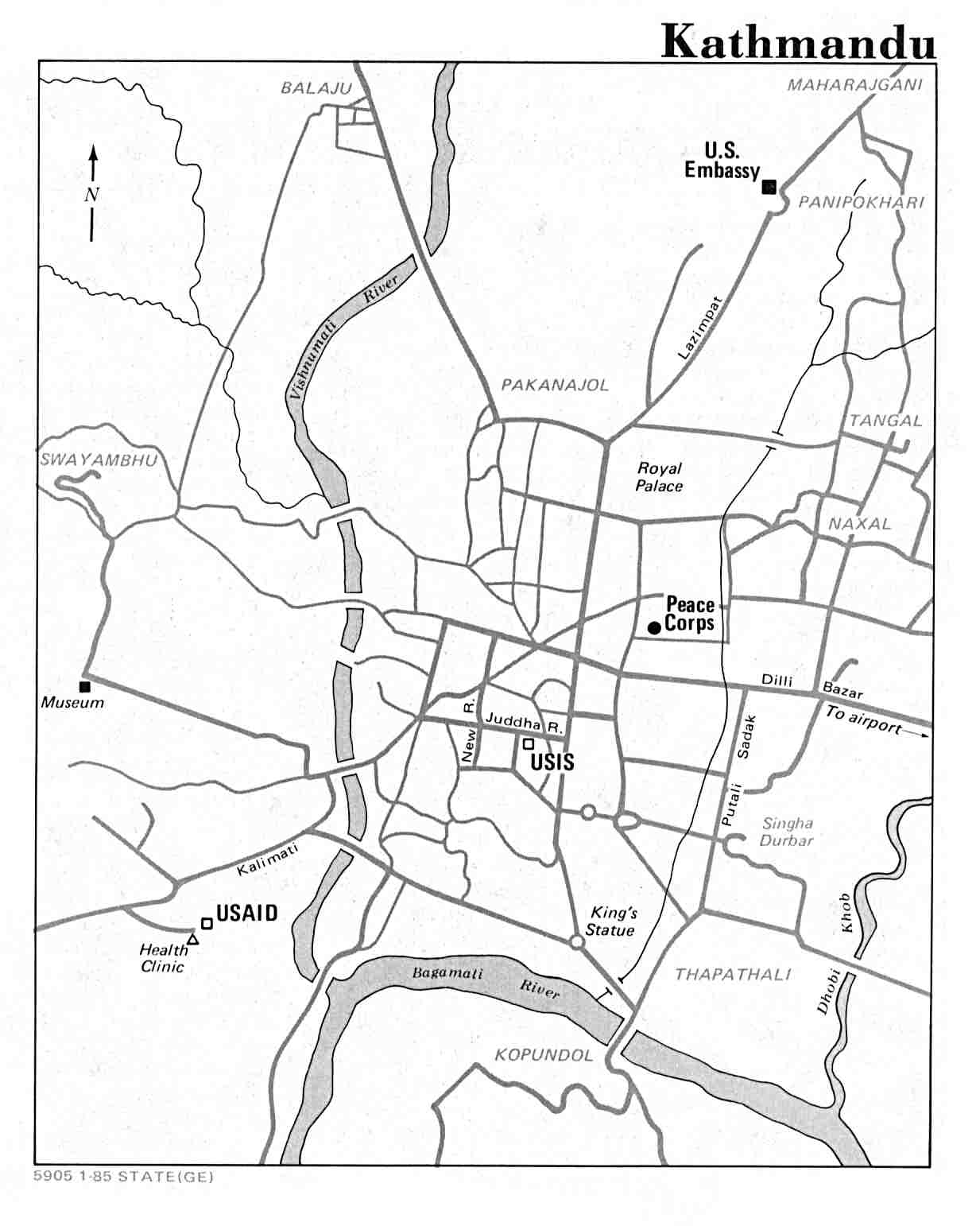
- ^ "Map of Kathmandu" United States Department of State, 1985
- ^ Kannel, Prakash Raj; Lee, S.; Lee, Y.-S.; Kanel, S. R.; Pelletier, G.J. (2007). "Application of automated QUAL2Kw for water quality modeling and management in the Bagmati River, Nepal". Ecological Modelling 202 (3–4): 503. doi:10.1016/j.ecolmodel.2006.12.033.
- ^ Shrestha S.H. p.35
- ^ Shreshta, Vinod Prasad (2007). "A Concise Geography of Nepal". Climate (Kathmandu: Mandal Publications). pp. 24–28. ISBN 978-99946-55-04-5.
- ^ a b "Average Temperature and Rainfall of Kathmandu City". Nepal Vista. Nepal Bureau of Standards, Weather Meteorology. Retrieved 2009-11-06.
- ^ "NORMALS FROM 1981-2010". Department of Hydrology and Meteorology (Nepal). Retrieved 14 October 2012.
- ^ "World Weather Information Service – Kathmandu". World Meteorological Organization. Retrieved April 16, 2013.
- ^ Cappelen, John; Jensen, Jens. "Nepal - Kathmandu". Climate Data for Selected Stations (1931-1960) (in Danish). Danish Meteorological Institute. p. 190. Retrieved April 16, 2013.
- ^ "Nepal - Katmandu". Centro de Investigaciones Fitosociológicas. Retrieved April 16, 2013.
- ^ Lewis, Todd T. "Buddhism, Himalayan Trade, and Newar Merchants". Retrieved 28 July 2012.
- ^ a b c "Economy". Kathmandu Metropolitan City, Government of Nepal. Retrieved 2009-12-20.
- ^ a b c d "Economy". Kathmandu Metropolitan City Office. Retrieved 2009-12-18.
- ^ a b Shrestha pp.86–89
- ^ "Jhamel". Nepali Times. Retrieved 12 March 2012.
- ^ Shrestha pp.86–87
- ^ "Hotels in Kathmandu". Kathmandu- hotels.com. Retrieved 2009-12-13.
- ^ "Metropolis Council". Kathmandu Metropolitan City Council, Government of Nepal. Retrieved 2009-12-14.
- ^ "Ward Profile". Kathmandu Metropolitan City Council, Government of Nepal. Retrieved 2009-12-14.
- ^ "Census Nepal 2001". Retrieved 13 July 2007.[dead link]
- ^ a b c d e "History and problem". Firefighters Volunteer Association of Nepal (FAN). Retrieved 2009-12-20.
- ^ "Census Nepal 2001". Retrieved 2009-12-13.[dead link]
- ^ http://census.gov.np/index.php?option=com_content&view=article&id=22&Itemid=22
- ^ "Population". Kathmandu Metropolitan City, Government of Nepal. Retrieved 2009-12-12.
- ^ National Census of Nepal 2011
- ^ a b Jha p.21
- ^ a b "Festivals". Kathmandu Metropolitan City, Government of Nepal. Retrieved 2009-12-12.
- ^ "Hanuman Dhoka (Old Royal Palace)". Retrieved 2009-12-20.
- ^ "Kumari Devi – The Living Goddess". Retrieved 2009-12-19.
- ^ "SAARC tourism". Nepal.saarctourism.org. Retrieved 2010-07-04.
- ^ a b c Mayhew, Bradley; Bindloss, Joe; Armington, Stan (2006). Nepal. Lonely Planet. p. 166. ISBN 978-1-74059-699-2.
- ^ "SAARC tourism".
- ^ "Spiritual guides". Vegetarian-restaurants.net. 2006-01-01. Retrieved 2010-07-04.
- ^ Snellgrove (1987), p. 365.
- ^ "Fables of Boudhanath and Changunarayan". nepalnews.com. Retrieved 2009-12-13.[dead link]
- ^ a b c Mayhew, Bradley; Bindloss, Joe; Armington, Stan (2006). Nepal. Lonely Planet. pp. 170–1. ISBN 978-1-74059-699-2.
- ^ "UNESCO".
- ^ a b "Introducing Changu Narayan Temple". Retrieved 2009-12-19.
- ^ Jha p.23
- ^ Jha pp.23–24
- ^ a b "Museums and Art Galleries of Nepal". Retrieved 2009-12-18.
- ^ a b c d e f g h i j k l m n o "Museums and art galleries". Asia Travel. Retrieved 2009-12-18.
- ^ Woodhatch, Tom (1999). "Nepal handbook". The Royal Palace (Footprint Travel Guides). p. 194. ISBN 978-1-900949-44-6. Retrieved 2009-12-17.
- ^ Mayhew, Bradley; Bindloss, Joe; Armington, Stan (2006). "Lonely Planet". The Royal Massacre (Lonely Planet). p. 38. ISBN 978-1-74059-699-2. Retrieved 2009-12-17.
- ^ Vibhaga, Nepal Sūcanā (1975). "Narayanhity Royal Palace, home of the King of Nepal". Royal Palace (His Majesty's Govt., Ministry of Communications, Dept. of Information). p. 5. Retrieved 2009-12-17.
- ^ "Kathmandu Contemporary Art Centre". Kathmanduarts.org. Retrieved 2010-07-04.
- ^ "Kathmandu International Theater Festival 2008". Aarohan Theatre Group. Retrieved 2009-12-22.
- ^ "The jazz peace". Nepali Times. 2006-09-29. Retrieved 2009-12-18.
- ^ a b c Lonely Planet (2003), pp. 91–92
- ^ http://www.nepalnews.com/home/index.php/business-a-economy/2532-intl-chain-pizza-hut-a-kfc-arrive-in-nepal.html
- ^ http://www.tripadvisor.com/Restaurant_Review-g293890-d2172681-Reviews-KFC-Kathmandu_Kathmandu_Valley_Bagmati_Zone_Central_Region.html
- ^ A whiff of sobriety The Economist]
- ^ "Katmandu as a world Heritage Site". publisher= Kathmandu Metropolitan City, Government of Nepal. Retrieved 2009-12-12.
- ^ L. S. Cousins (1996), "The dating of the historical Buddha: a review article", Journal of the Royal Asiatic Society (3)6(1): 57–63.
- ^ "Nepal in Figures 2006". Government of Nepal. Retrieved 2009-12-18.[dead link]
- ^ "Churches in Nepal". Retrieved 2009-12-20.
- ^ "US Department of State: Diplomacy in Action". US Department of State. Retrieved 2009-12-20.
- ^ "Science, research and technology in Nepal" (PDF). Bajracharya, Dayanand; Bhuju, Dinesh Raj; Pokhrel, Jiba Raj. UNESCO Kathmandu Office. Retrieved 2009-11-13.
- ^ "List of medical colleges of Nepal". Medchrome.com. 2009-12-26. Retrieved 2012-01-15.
- ^ "Goal Programme – All-Nepal Football Association – 2001". FIFA. Retrieved 2009-12-20.
- ^ Shrestha pp.91–96
- ^ a b "Tribhuvan International Airport at Civil Aviation Authority of Nepal".[dead link]
- ^ "New routes launched during the last week 10-16-october/".
- ^ Health Mark Innovations
- ^ Ramon Magsaysay Award Foundation
- ^ healio
- ^ Prince Mahidol Award
- ^ University of Utah Health Care
- ^ "MyRepublica and IHT enter into publishing alliance, to publish Asia pacific edition of IHT". MYRepublica. Retrieved 2012-02-10.
- ^ "Nepal Country Profile". British Broadcasting Corporation (BBC). 2009-08-19. Retrieved 2009-12-22.
- ^ "About Nepal". Retrieved 2009-12-22.
- ^ "Outline of International Relations of Kathmandu Metropolitan City" (PDF). Katamandu Metropolitan City, Government of Nepal. Retrieved 2009-12-20.
- ^ "Twin towns and Sister cities of Minsk [via WaybackMachine.com]" (in Russian). The department of protocol and international relations of Minsk City Executive Committee. Archived from the original on 2 May 2013. Retrieved 2013-07-21.
References
- Beal, Samuel (1884). Si-Yu-Ki: Buddhist Records of the Western World, by Hiuen Tsiang. 2 vols. Translated by Samuel Beal. London. 1884. Reprint: Delhi. Oriental Books Reprint Corporation. 1969.
- Mayhew, Bradley; Bindloss, Joe; Armington, Stan (2006). Lonely Planet. Lonely Planet. p. 416. ISBN 978-1-74059-699-2.
- Mayhew, Bradley; Bindloss, Joe; Armington, Stan (2006). Nepal. Lonely Planet. p. 166. ISBN 978-1-74059-699-2.
- Mayhew, Bradley; Brown, Lindsay, Vivequin, Wanda (2003). Lonely Planet Nepal. Lonely Planet. ISBN 978-1-74059-422-6.
- Nanjio, Bunyiu (1883). A Catalogue of the Chinese Translation of the Buddhist Pantheon. Oxford at the Clarendon Press.
- Shaha, Rishikesh (1992). Ancient and Medieval Nepal. Manohar Publications, New Delhi. ISBN 978-81-85425-69-6.
- Shreshta, S.H (2005). Nepal in Maps. Kathmandu: Educational Publishing House. p. 129.
- Shreshta, Vinod Prasad (2007). A Concise Geography of Nepal. Kathmandu: Mandal Publications. p. 126. ISBN 978-99946-55-04-5.
- Snellgrove, David (1987). Indo-Tibetan Buddhism: Indian Buddhists & Their Tibetan Successors. Two Volumes. Shambhala Publications, Boston. ISBN 978-0-87773-311-9 (v. 1); ISBN 978-0-87773-379-9 (v. 2).
- Tamot, Kashinath, and Ian Alsop. (2001). "A Kushan-period Sculpture from the reign of Jaya Varma-, AD 184/185, Kathmandu, Nepal." (2001). Asianart.com
- Tamot, Kashinath, and Ian Alsop. (date unknown. Update of previous article). "A Kushan-period Sculpture from the reign of Jaya Varman, AD 185, Kathmandu, Nepal." Asianart.com
- Thapa, Rajesh Bahadur, Murayama, Yuji, and Ale, Shailja (2008). "City Profile: Kathmandu". Cities, Vol.25 (1), 45–57. doi:10.1016/j.cities.2007.10.001
- Thapa, Rajesh Bahadur and Murayama, Yuji (2009). Spatiotemporal Urbanization Patterns in Kathmandu Valley, Nepal: Remote Sensing and Spatial Metrics Approaches. Vol.1 (3), 534–556. doi:10.3390/rs1030534
- Thapa, Rajesh Bahadur and Murayama, Yuji (2010). Drivers of urban growth in the Kathmandu valley, Nepal: Examining the efficacy of the analytic hierarchy process Applied Geography, Vol. 30 (1), 70–83. doi:10.1016/j.apgeog.2009.10.002
- Thapa, Rajesh Bahadur and Murayama, Yuji (2011). Urban growth modeling of Kathmandu metropolitan region, Nepal. Computers, Environment and Urban Systems, Vol 35 (1) 25–34. doi:10.1016/j.compenvurbsys.2010.07.005
- Vibhaga, Nepal Sūcanā (1975). Narayanhity Royal Palace, home of the King of Nepal. His Majesty's Govt., Ministry of Communications, Dept. of Information. p. 14.
- Watters, Thomas. (1904–5). On Yuan Chwang’s Travels in India. (AD 629–645). Royal Asiatic Society. Second Indian Edition. Munshhiram Manoharlal Publishers, New Delhi. (1973).
- Woodhatch, Tom (1999). "Nepal handbook". The Royal Palace (Footprint Travel Guides). p. 194. ISBN 978-1-900949-44-6. Retrieved 2009-12-17.
External links
| Find more about Kathmandu at Wikipedia's sister projects | |
| Definitions and translations from Wiktionary | |
| Media from Commons | |
| Learning resources from Wikiversity | |
| Quotations from Wikiquote | |
| Source texts from Wikisource | |
| Textbooks from Wikibooks | |
| Travel guide from Wikivoyage | |
- Kathmandu Lonely Planet
- Digital Kathmandu 3d flyer navigator software by OOPSLite Technologies[dead link]
- A Kushan-period Sculpture from the reign of Jaya Varma-, AD 184/185 Kathmandu, Nepal.
- A Kushan-period Sculpture from the reign of Jaya Varman, AD 185. Kathmandu, Nepal Updated but shortened version of previous entry
- Kathmandu Sights and Scenes
- Kathmandu Destination Guide from whl.travel
- Tour of Nepal
- Hippies in Kathmandu
- Vintage footage of Kathmandu
- I am Kathmandu Directory of Places in the Kathmandu Valley
- Yalamandu Post Up to date day-to-day information - a useful tool for those living in Kathmandu valley
- Explore Nepal: Kathmandu
|
||
|
||
|
||||